Full Finnish Geodata Package - Now Available in windPRO
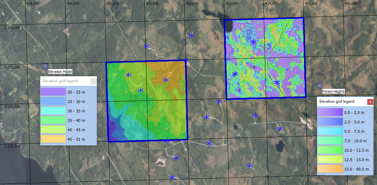
windPRO users developing wind farms in Finland are now able to access a comprehensive package with very high-resolution Finnish national geodata. The data is easily reached through the online-data services in windPRO 3.2+. Available data includes full Finnish coverage of: The national elevation model (10m resolution), forest height data (16m resolution) and existing wind turbine positions. Finally, also topographic maps and orthophotos are available in different resolutions as dynamic zoomable maps.

The picture above shows part of the wind farm Ii / Myllykangas. It holds four of the new Finnish geo-datasets in windPRO: Finnish orthophoto as background map, the digital elevation model (10m grid), the forest height model (16m grid) and the existing turbine locations.
Read More:
A full set of documentation pages on the new Finnish datasets are available on the windPRO knowledgebase (//help.emd.dk/mediawiki/)
Contact Us:
Feel free to reach out to the windPRO hotline for any comments or suggestions: support@emd.dk.
Meet Us:
Visit Thomas and Morten at the EMD-stand during the WinterWind conference in Umeå, Sweden on February 4-6, 2019
Data Acknowledgements:
National Land Survey of Finland and Natural Resources Institute Finland (LUKE).
With best regards,
EMD International A/S