windPRO Germany – New datasets in Baden-Württemberg
Our EMD online-data team have just launched a set of digital elevation models derived from the Landesamt für Geoinformation und Landentwicklung Baden-Württemberg (LGL) open geodata sources.
Baden-Württemberg
(derived from the Landesamt für Geoinformation und Landentwicklung Baden-Württemberg (LGL) open geodata sources)
What you gain:
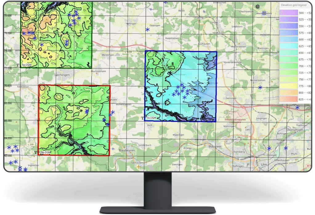
✅ Available in 1m, 5m, and 20m resolutions, these models are perfect for diverse windfarm analysis and PV-modelling needs.
✅ The 1m resolution is ideal for detailed photomontage modelling (e.g. PV-plants)
✅ The 5m and 20m versions, resampled by EMD, ensure efficient handling of larger modelling domains
✅ Reflecting the latest status as of June 2024, the data is based on lidar-scans from 2016-2021, with the 1m dataset offering an impressive vertical accuracy of ±0.15m.